- Trails
-
Bikes
-
Gear
-
Tips & Tricks
-
About us
 3.9 mi
 32 mi
32 mi
 2.5 mi
 3.5 mi
 15.5 mi
From leisurely rides along the Sacramento River to challenging mountain bike trails in the nearby foothills, there's something for everyone. So, get ready to hit the trails and explore the best bike routes near Sacramento.
Sacramento is located in the northern portion of California's Central Valley, known for its hot summer Mediterranean climate, fertile farmlands, and diverse terrain. While the immediate area surrounding Sacramento is primarily flat, with plenty of urban and suburban landscapes, many nearby regions offer a variety of landscapes for cyclists to explore
To the west of Sacramento, cyclists can venture into the Coastal Range, which offers a mix of rugged mountains, dense forests, and rolling hills. The Sierra Nevada Mountains are to the east of Sacramento, which is known for its alpine landscapes, rocky peaks, and stunning lakes.
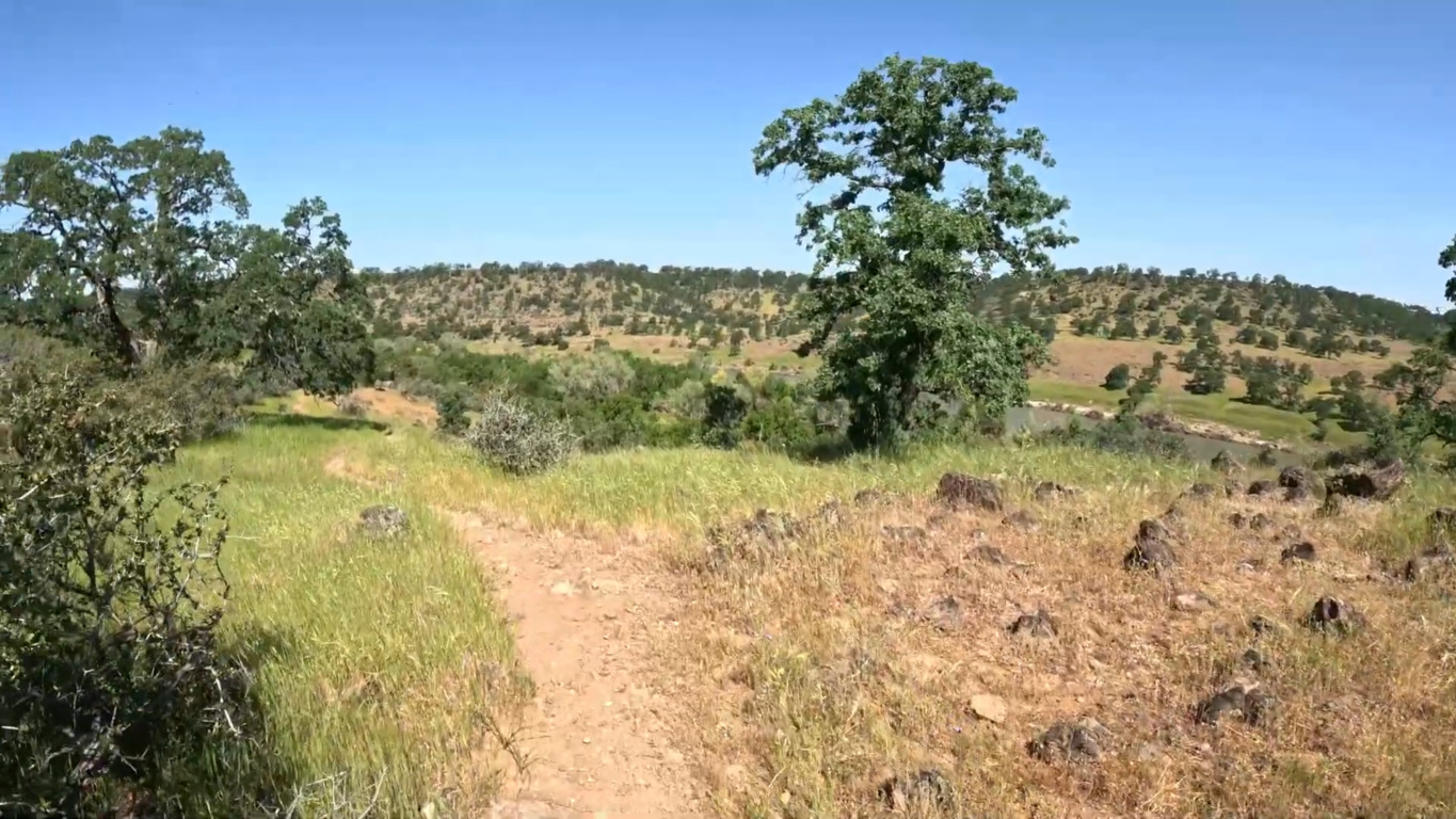
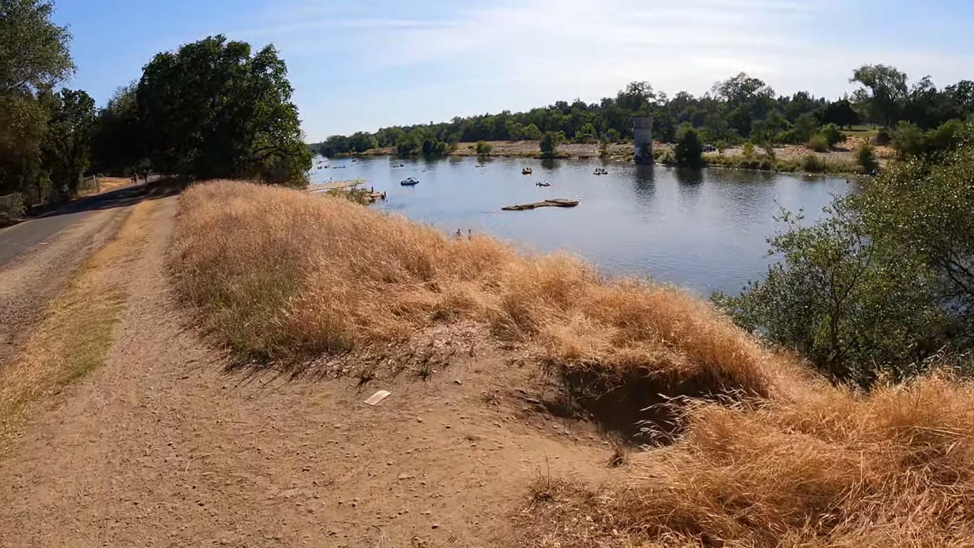
The city is known for its abundant urban forest leading to the name City of Trees. Sacramento has more trees per capita than any other city or town worldwide. Cyclists can explore the American River Parkway, which offers a scenic trail that runs along the American River. This trail meanders through lush woodlands, meadows and along the riverbanks, providing a tranquil and picturesque setting for riders.
| Land Area | 97.68 mi2 (253 km2) |
| Minimum Elevation | 30 ft. (9 m) |
| Maximum Elevation | 831 ft. (253 m) |
Sacramento has 524,943 residents with a median age of 33 years. There are 174,624 households, and more than half (59.4%) are families. The average household size in Sacramento is 2.62, while the average family size is 3.37.
The biggest percentage (29.8%) were aged between 25 and 44, followed by 24.9% under 18. 23.5% of the population are aged 45 to 64, while 11.2% fall within the 18 to 24 age range. The older population is the smallest percentage, with only 10.6% of people aged 65 or older. For every 100 females, there are 94.9 males.
Non-Hispanic whites comprise the biggest portion of the population (34.5%), followed by Hispanic or Latinos of any race, with 138,165 persons (26.9%). People of Mexican heritage come close with 22.6%. 18.9% of the population is Asian, while African Americans make up 13.2%.
The city ranks seventh in one of the highest LGBTQ populations per capita in the US, with roughly 10% of the total population identifying as lesbian, gay, transgender or bisexual.
| Total population (2020) | 524,943 |
| Population density | 5,374.11/mi2 |
Sacramento has a Mediterranean climate with hot, dry summers and mild, wet winters. The rainy season typically lasts from October to April, although there may be occasional light rainfall in June or September. The average high temperature in the summer (June to August) is around 93°F, while the average low temperature in the winter (December to February) is around 40°F. Rainfall is more common during the winter months, with occasional heavy downpours.
A sea breeze known as the "delta breeze" can occasionally moderate the summer heat, bringing cool temperatures at night. Sacramento experiences its foggiest conditions in December and January, with the Tule fog being the most common. The fog can be so dense that visibility can be less than 100 feet (30 meters), posing hazardous driving conditions.
The Tule fog can last for several consecutive days or even weeks, with temperatures not exceeding 50 °F. Snowfall is rare in Sacramento, and it tends to melt upon ground contact, but intense showers can produce a significant amount of hail during spring storms.
The best time for biking in the Sacramento area is typically in the spring and fall months when the weather is mild and the temperatures are comfortable for outdoor activities. In the spring months (March to May), temperatures range from the mid-60s° to the low 80s°F. In the fall months (September to November), temperatures range from the mid-60s°F (around 18°C) to the mid-80s°F
While riding year-round in the Sacramento area is possible due to its mild winters, fewer trails are available for winter biking. Some mountain bike trails, such as the River Bend Park Riverside Loop and the Gateway Oaks Trail, remain open during the winter, but these trails may be covered in snow or ice and require additional equipment and precautions.
| Month | Average Temperature (Low) | Average Temperature (High) |
|---|---|---|
| January | 40℉ | 55℉ |
| February | 43℉ | 61℉ |
| March | 46℉ | 66℉ |
| April | 49℉ | 73℉ |
| May | 53℉ | 81℉ |
| June | 58℉ | 89℉ |
| July | 60℉ | 93℉ |
| August | 60℉ | 93℉ |
| September | 57℉ | 88℉ |
| October | 52℉ | 78℉ |
| November | 45℉ | 64℉ |
| December | 40℉ | 55℉ |
Sacramento has a well-developed transportation infrastructure, with several access roads for buses and other public transportation options. The Sacramento Regional Transit District (SacRT) operates an extensive bus network throughout the city and its suburbs, with several bus stops near popular bike trails.
Several facilities are also available for cyclists' convenience, including bike racks and repair stations located along many of the city's bike trails. Additionally, some bike trails are equipped with restrooms and drinking fountains.
There are plenty of cafés and restaurants located throughout the city, with a wide variety of dining options available. Some popular cafés in the region include Temple Coffee Roasters, Insight Coffee Roasters, and Old Soul Co. Additionally, many of the city's parks and recreational areas have picnic areas and snack bars, providing additional food options for cyclists.
The city is a Silver Level Bicycle Friendly Community and celebrates bike month in May. Sacramento also has a dedicated bicycle path on the American river parkway. While there may be occasional obstacles on some of the city's bike trails, such as traffic and congestion, most trails are well-maintained and accessible to cyclists of all skill levels.
Sacramento is home to numerous sights and landmarks that cyclists can explore while mountain biking. One of the most popular landmarks is the American River Parkway, which offers a scenic bike trail stretching along the riverbank. You can enjoy stunning views of the river, as well as spot various wildlife species such as deer, coyotes, and rabbits while biking.
Another popular landmark is the Folsom Lake State Recreation Area, located northeast of Sacramento. This recreation area offers several mountain biking trails, including the South Fork Trail, which offers a challenging ride with stunning views of the surrounding mountains.
Sutter's Fort is a must-visit landmark for history buffs. This historic park showcases the rich history of Sacramento’s agriculture and trade dating back to the mid-19th century. Cyclists can explore the park's various exhibits and buildings, including the restored adobe walls and blacksmith shop.
The Sacramento Zoo is also a popular landmark for cyclists, with a bike path located nearby that offers easy access to the zoo. Cyclists can enjoy a leisurely ride through the park and take in the sights of various animal exhibits, including lions, tigers, and giraffes. Other notable landmarks include the California State Capitol Building, the Crocker Art Museum, and the Tower Bridge, which offers stunning views of the Sacramento River.
Sacramento is considered a bike-friendly city due to its many bike lanes, trails and infrastructure in place to support cycling as a mode of transportation and recreation. The city has invested in expanding its network of bike lanes and trails and has implemented several initiatives to promote cycling, such as the "Sacramento Area Bicycle Advocates" (SABA) and the "BikeShare" program.
Additionally, Sacramento hosts several annual bike events and activities, including the "Amgen Tour of California" bike race and the "Bike Month" celebration in May, which encourages residents to bike to work, school, and other destinations.
The longest bike trail in Sacramento is the American River Bike Trail: Sacramento State to Folsom Lake Segment. The trail is long and paved and takes about 15 hours to complete. It is open all year round and has the most elevation gain of all trails in the area.
The rules regarding dogs on bike trails in Sacramento can vary depending on the specific trail and location. Trails like the American River Trail, Jedediah Smith Memorial Trail and Folsom South Canal Recreation Trail allow cyclists to bring their dogs with them.
However, you will be required to put the dog on a leash at all times and clean up after them. Always check the rules and regulations regarding pets for the specific bike trail you plan on riding before embarking on your journey.